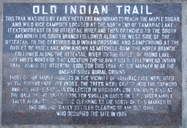
| 1963 Becker County Historical Society
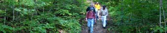
marker at trail head
This trail was used by early settlers and indians to reach the maple sugar and wild rice campsite located at the north end of Tamarac Lake. It extended east to the Ottertail River and then brached to the south and north the south branch followed along the west side of the Ottertail to the centuries old indian crossing and campground at the outlet of Rice Lake now known as aMitchell Dam. The north branch followed along the Ottertail River to the outlet of round lake. Five miles north of the location the heavily used Yellowhead indian trail joined the Ottertail. Look for this trail at the marker near the ancient sioux burial ground.
Most of the maple forests in the vicinity of Tamarac Lake were used by the indians until the 1930's. The trees were gashed into the sapwood and the maple sap was collected in birchbark containers placed at the base of the trees look for swollen bases on the larger maple trees along the trail the clearing to the north of this marker is the original family settler clearing of Mr. Ole Dahl who occupied the site in 1905. |